
Having your project scanned ahead of the bid process will ensure all bidders have the geophysical information they need to produce an accurate bid.
For our scanning services, ScanStar utilizes the latest in high definition scanning technology to assist our clients worldwide in planning and executing projects more efficiently.
Project managers, engineers, and architects are able to better visualize the true as-built conditions of any facility or site.
This means that we are better able to understand the building conditions, and make better decisions.

INDUSTRIES SERVED
- Food & Beverage
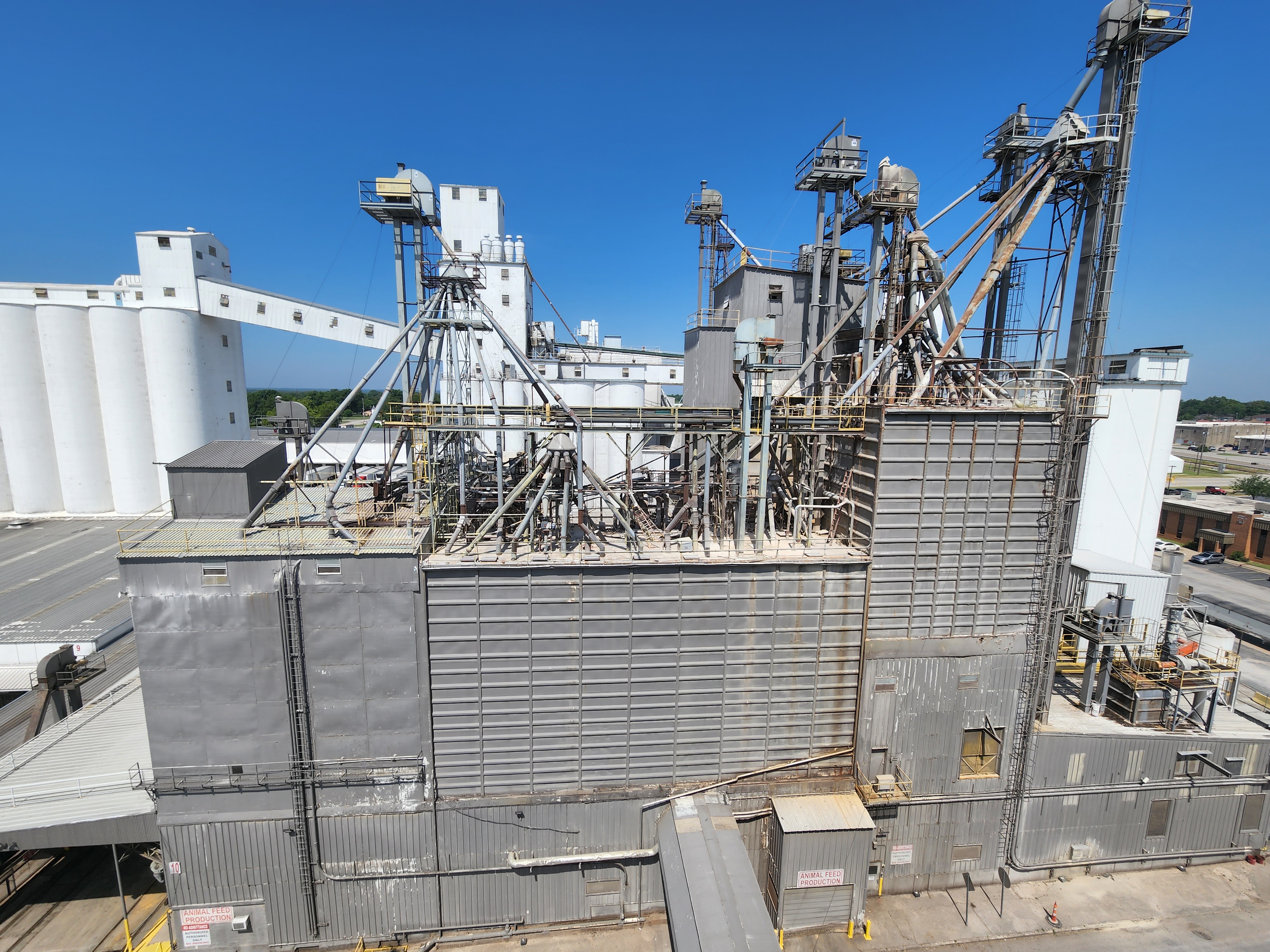
- Dry Bulk Material Handling
- Industrial
- Original Equipment
Manufacturers - Power Suppliers
- Pulp & Paper
- Refineries & Ethanol Plants
- Steam & Condensate System
Design - And More!
COMMON APPLICATIONS INDUSTRIES SERVED PREVIOUS PROJECTS
- Structures
- Towers
- Tanks
- Silos
- Grain Bins
- Hoppers
- Conveyors
- Spouting
- Grain Elevators
- Machinery
- Boiler Rooms
- Loading Docks
- Cat Walks
- Terrain
- Landforms
- And More!
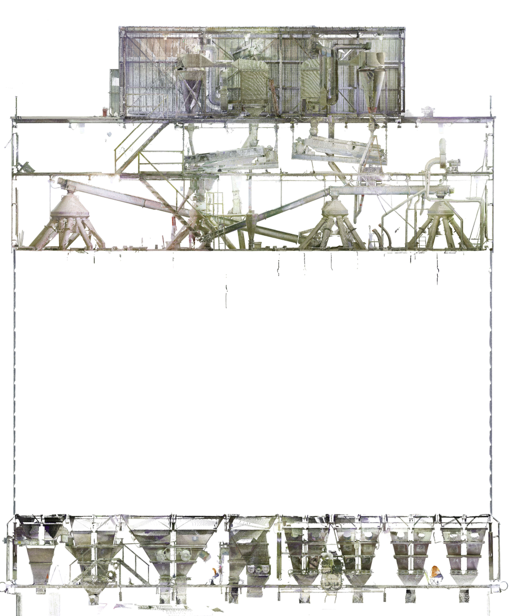
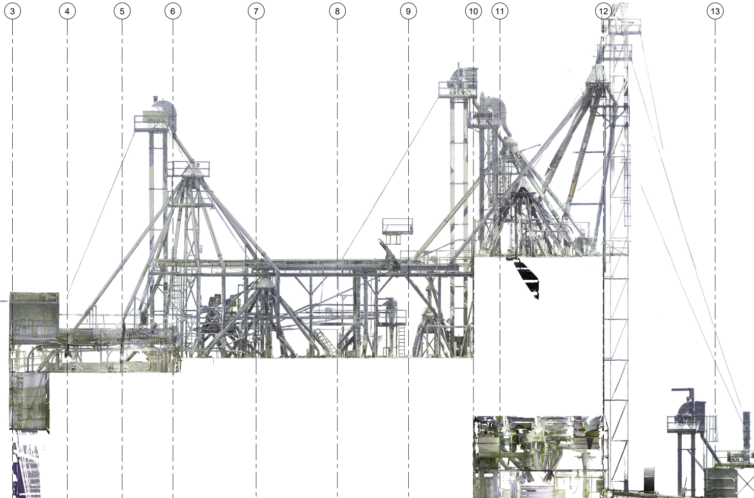
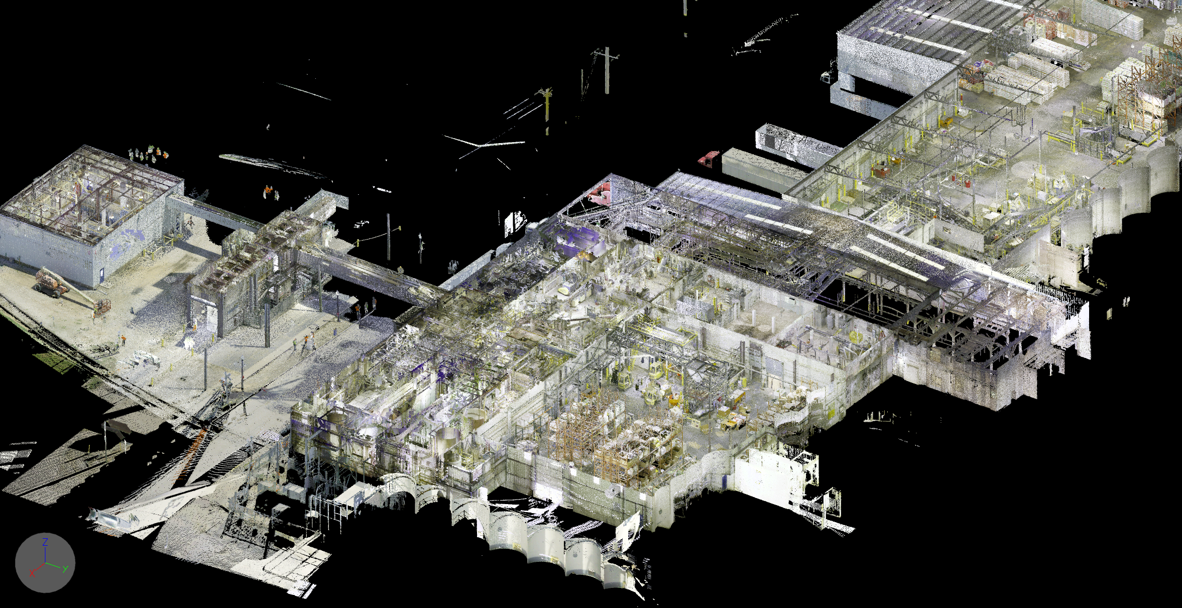
WHAT IS A POINT CLOUD?
- ScanStar will use lasers and drones to scan your indoor or outdoor space. (Or both!)
- These tools will provide ScanStar with data points.
- ScanStar transcribes this data into a precisely scaled
presentation of your facility as a 3-D image. This image is
known as your Point Cloud A.K.A. your facility’s Digital Twin.
HOW TO USE YOUR POINT CLOUD
- Point Cloud can be imported to AutoCAD,
Autodesk, and Navisworks software - Coordinates can be set to UTM,
Lat/Long, MGRS, etc. - Accuracy up to 2 millimeters
- Web-based models available on request
WHEN DO YOU USE YOUR POINT CLOUD?
- To measure equipment, spaces, and
structures right from your desktop - Develop presentations and create plans
- Reference during construction or modification of facilities
- Easily share detailed information with contractors,
earthmoving companies, surveyors, and more - To label and locate equipment in your facility
WHY DO YOU NEED A POINT CLOUD?
- Improve efficiencies, optimize workflow, and
detect potential problems before they occur - Lower costs and reduce change orders
- Expedite design planning
- Improve communication
- Improve responsiveness to project changes
- Schedule reduction
- Increase worker safety by eliminating
manual measurements - Improved quality control
- 3-D visualization and spatial analysis (i.e. line-of-sight, etc.)